


20181206-La Bouille

doudet
User

Length
11.8 km

Max alt
138 m

Uphill gradient
246 m
Km-Effort
15.1 km

Min alt
0 m

Downhill gradient
246 m
Boucle
Yes
Creation date :
2018-12-06 13:20:55.149
Updated on :
2018-12-07 08:05:25.81
3h27
Difficulty : Difficult

FREE GPS app for hiking
 SityTrail
IGN / Geographical institutes
SityTrail Plus
The world is yours!
About
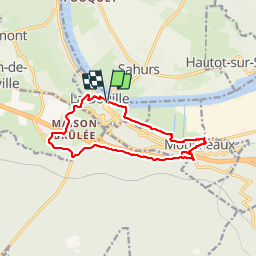
Trail Walking of 11.8 km to be discovered at Normandy, Seine-Maritime, La Bouille. This trail is proposed by doudet.
Description
Boucle A-R au départ du Parking du Bac de la Bouille
Photos


Positioning
Country:
France
Region :
Normandy
Department/Province :
Seine-Maritime
Municipality :
La Bouille
Location:
Unknown
Start:(Dec)
Start:(UTM)
349897 ; 5468550 (31U) N.
Comments